Smart Planning · AI
Nexus Urban — Smart Planning Support System
"From fragmented data to unified spatial intelligence — how cities plan, decide, and engage."
AI Scenario BuilderParticipation PortalSPSS
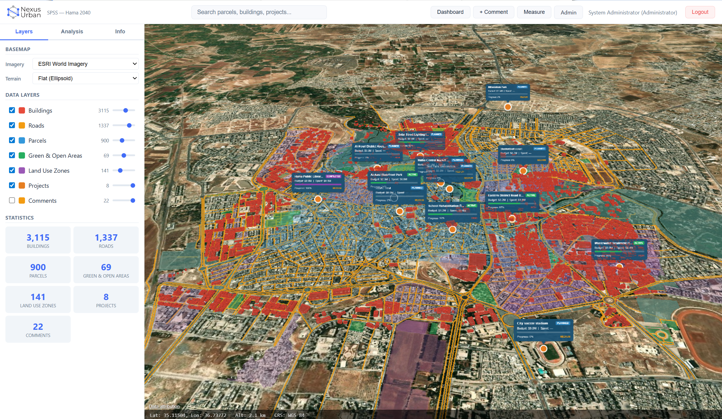
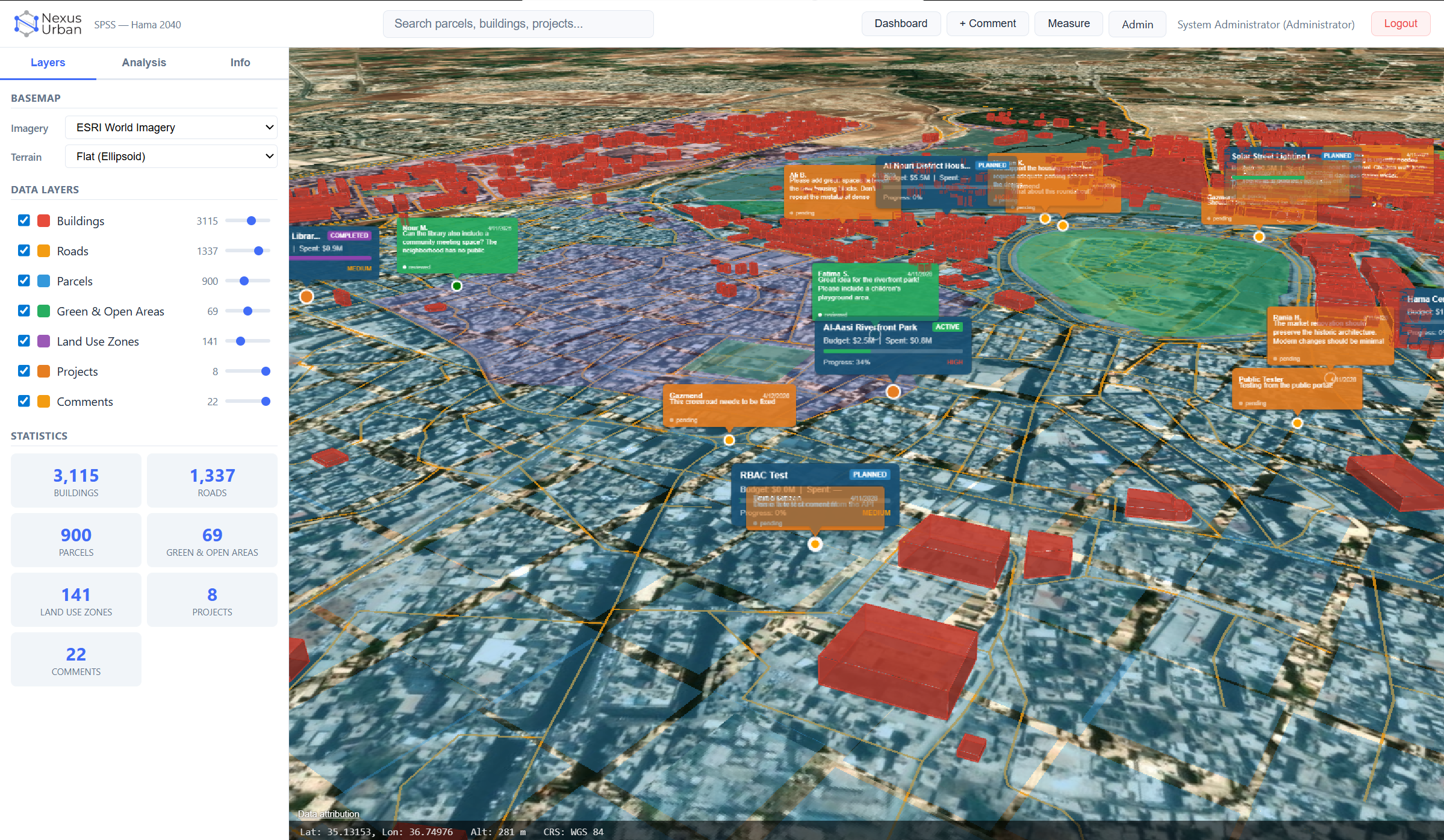
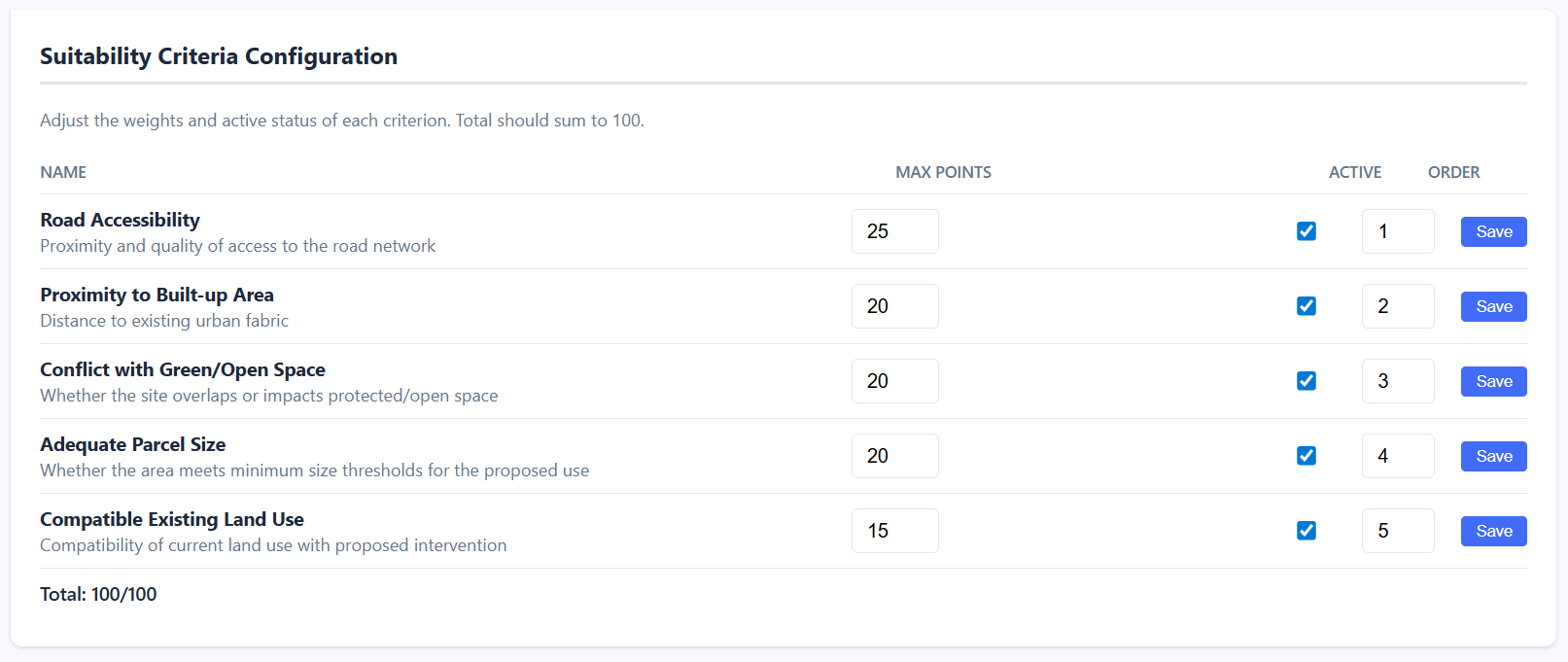
Nexus Urban is INS's AI-enabled Smart Planning Support System — a unified spatial data, analytics, and stakeholder participation platform purpose-built for urban and strategic planning authorities. Transforms fragmented, paper-driven planning into a single, live digital ecosystem supporting data-driven decision-making and citizen engagement.
Define density, floor count, and green preservation targets for any zone. The engine computes floor area ratio, population capacity, green loss, and feasibility, with side-by-side scenario comparison.
Compare land-use classifications across time periods and automatically identify changed zones. Visualise shifts, such as agricultural to residential or vacant to commercial, directly on the 3D map.
A no-login citizen portal for geo-located comments, surveys, and project exploration. Comments appear as speech bubbles on the 3D map and are visible to planners in the internal viewer.
A unified PostGIS spatial database integrates buildings, roads, parcels, green areas, and land-use snapshots across time periods, with GIST spatial indexes and real-time ST_ function analysis.
A four-role security model for Admin, Planner, Viewer, and Public, with JWT authentication, endpoint-level permission enforcement, and full audit logging of every user action.
Consolidate data from city systems — sensors, cadastre, transport, demographics — into a unified spatial analytics platform.
Manage existing zoning plans, simulate land use change impacts, and model alternative development scenarios.
Analyse and simulate transport flows, modal splits, and infrastructure capacity under current and future demand.
Assess noise, air quality, flooding risk, and green space distribution to support sustainable planning decisions.
Georeferenced 3D city model for urban design review, public consultation, and planning authority presentations.
Web platform for citizen consultation, feedback collection, and transparent communication of planning proposals.
We'll walk you through the platform with real-world scenarios matching your use case. Our team typically responds within one business day.